


Voting District 0004, Loving County, Texas
About
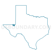
Outline

Summary
| Unique Area Identifier | 675526 |
| Name | Voting District 0004 |
| County | Loving County |
| State | Texas |
| Area (square miles) | 282.20 |
| Land Area (square miles) | 282.09 |
| Water Area (square miles) | 0.11 |
| % of Land Area | 99.96 |
| % of Water Area | 0.04 |
| Latitude of the Internal Point | 31.82073130 |
| Longtitude of the Internal Point | -103.48655930 |
Maps


Graphs
Select a template below for downloading or customizing gragh for Voting District 0004, Loving County, Texas


Neighbors
Neighoring Voting District (by Name) Neighboring Voting District on the Map
- Voting District 0001, Loving County, TX
- Voting District 0002, Loving County, TX
- Voting District 0003, Loving County, TX
- Voting District 0101, Winkler County, TX
- Voting District 0202, Winkler County, TX
- Lea County Precinct 73, Lea County, NM
Top 10 Neighboring County Subdivision (by Population) Neighboring County Subdivision on the Map
- Kermit CCD, Winkler County, TX (6,120)
- Jal CCD, Lea County, NM (2,175)
- Wink CCD, Winkler County, TX (990)
- Mentone CCD, Loving County, TX (82)
Top 10 Neighboring Unified School District (by Population) Neighboring Unified School District on the Map
Top 10 Neighboring State Legislative District Lower Chamber (by Population) Neighboring State Legislative District Lower Chamber on the Map
- State House District 81, TX (159,026)
- State House District 74, TX (143,566)
- State House District 61, NM (28,541)
Top 10 Neighboring State Legislative District Upper Chamber (by Population) Neighboring State Legislative District Upper Chamber on the Map
Top 10 Neighboring 111th Congressional District (by Population) Neighboring 111th Congressional District on the Map
Top 10 Neighboring Census Tract (by Population) Neighboring Census Tract on the Map
- Census Tract 9, Lea County, NM (2,175)
- Census Tract 9504, Winkler County, TX (1,424)
- Census Tract 9501, Loving County, TX (82)